- All
- Historical Paths
- Natural Park
- The Ampezzo Nature
- The Dolomites
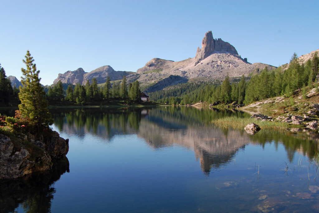
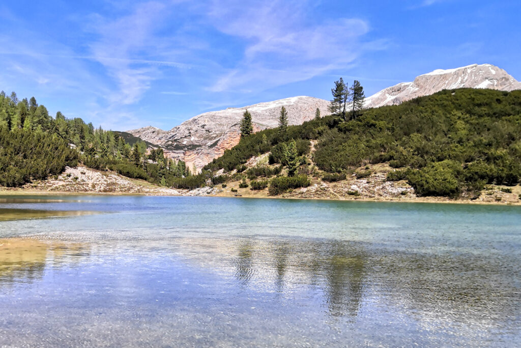
Lake Fedèra
Departure and arrival point: Capanna Ravà 2000 (6560 ft) Rucurto 1700 m (5577 ft) Distance: 11,8 km (7.4 mi) Elevation gain: ascent 590 m (1935 ft) descent 730 m (2395 ft) Difficulty: Moderate Brief description: trail around Croda da Lago with destination Lake Fedèra. The hike starts at Capanna Ravà, on the main road leadingRead More »Lake Fedèra
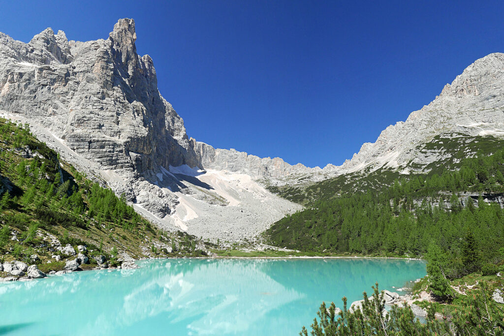
Lake Sorapìs
Departure and arrival point: Passo Tre Croci 1803 m (5915 ft) Distance: 14,9 km (9.3 mi) Elevation gain: 850 m (2790 ft) Difficulty: Hard Brief description: loop trail to Lake Sorapis, one of the most beautiful places in the Dolomites. Lake Sorapìs is undoubtedly the most popular destination for hikers visiting Cortina d'Ampezzo. Regretfully, theRead More »Lake Sorapìs
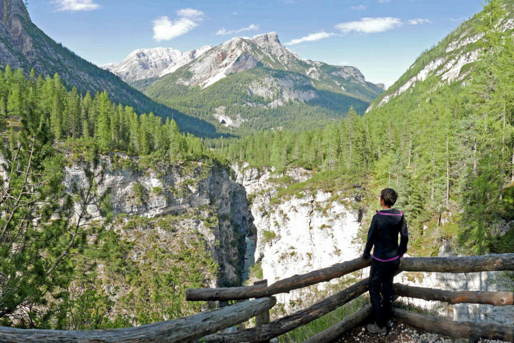
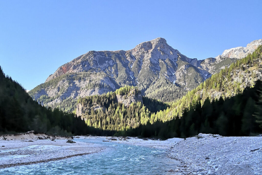
Canyon and Waterfall Trail
Departure and arrival point: Pian de Loa 1314 m (4310 ft) Distance: 11,5 km (7.2 mi) Elevation gain: 550 m (1800 ft) Difficulty: Hard Brief description: hike along the most beautiful waterfall and canyon system in the Dolomites. Among the many unique and truly beautiful sites that make Cortina d'Ampezzo famous is the canyon carvedRead More »Canyon and Waterfall Trail
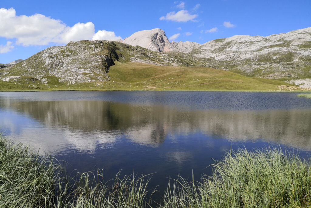
The Lakes of Fòses
Departure and arrival point: Val Salata 2000 m (6560 ft) by jeep; St. Hubertus 1449 m (4754 ft) Distance: 13,6 km (8.5 mi) Elevation gain: ascent 450 m (1476 ft) descent 1150 m (3772 ft) Difficulty: Moderate Brief descriptions: from Sénes to St. Ubertus, via the stunning Lakes of Fòses. This hike departs from theRead More »The Lakes of Fòses
Val Padeon
Departure and arrival point: Passo Tre Croci 1800 m (6168 ft) Ospitale 1490 m (4888 ft) Distance: 9,4 km (5.6 mi) Elevation gain: ascent 350 m (1150 ft) descent 620 m (2035 ft) Difficulty: Moderate Brief description: point-to-point crossing of the solitary Val Padeon. We begin our hike at Passo Tre Croci and we followRead More »Val Padeon
Lerosa Pass
Departure and arrival point: Malga Ra Stua 1668 m (5470 ft) Distance: 9 km (5.6 mi) Elevation gain: 420 m (1378 ft) Difficulty: Moderate Brief description: loop in the heart of the Natural Park of the Dolomiti d’Ampezzo. Our hike starts just past Malga Ra Stua, and it follows an old military trail leading toRead More »Lerosa Pass
Monte Piana 2324 m (7525 ft)
Departure and arrival point: Lago d'Antorno 1880 m (6168 ft) Carbonin 1450 m (4757 ft) Distance: 10,6 km (6.6 mi) Elevation gain: ascent 530 m (1740 ft) descent 900 m (2950 ft) Difficulty: Hard Brief description: point-to-point trail across Monte Piana. Mount Piana is located in the Tre Cime Natural Park, rising between Lake MisurinaRead More »Monte Piana 2324 m (7525 ft)
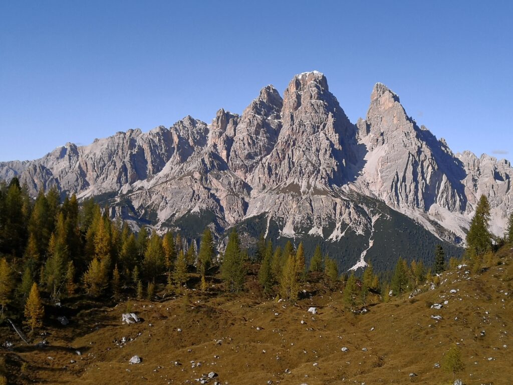
The Castle of Andraz and the peak of mount Sief 2424m (7953 ft)
Departure and arrival point: Castello di Andraz 1750 m (5740 ft) Distance: 10,2 km (6.3 mi) Elevation gain: 700 m (2300 ft) Difficulty: Moderate Brief description: loop trail from the Castle of Andraz to the top of mount Sief and back. The Castle of Andraz is built on a large boulder which most probably detachedRead More »The Castle of Andraz and the peak of mount Sief 2424m (7953 ft)
From Ospitale to Podestagno
Departure and arrival point: Ospitale 1491 m (4890 ft) Fiames 1300 m (4265 ft) Distance: 10,2 km (6.3 mi) Elevation gain: ascent 250 m (820 ft) discent 330 m (1083 ft) Difficulty: Moderate Brief description: point to point trail from Ospitale to the remains of the Castle of Podestagno and of the Villa of SaintRead More »From Ospitale to Podestagno
The Dolomieu trail
Departure and arrival point: Funivia Faloria 1224 m (4015 ft) Distance: 11 km (6.8 mi) Elevation gain: ascent 100 m (328 ft) descent 900 m (2953 ft) Difficulty: Moderate Brief description: the trail offers spectacular views of Cortina and the Ampezzo Valley. We begin by taking the cable car from the center of town toRead More »The Dolomieu trail
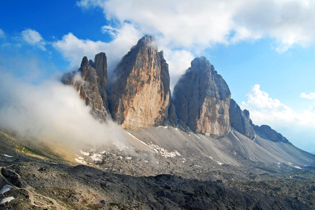
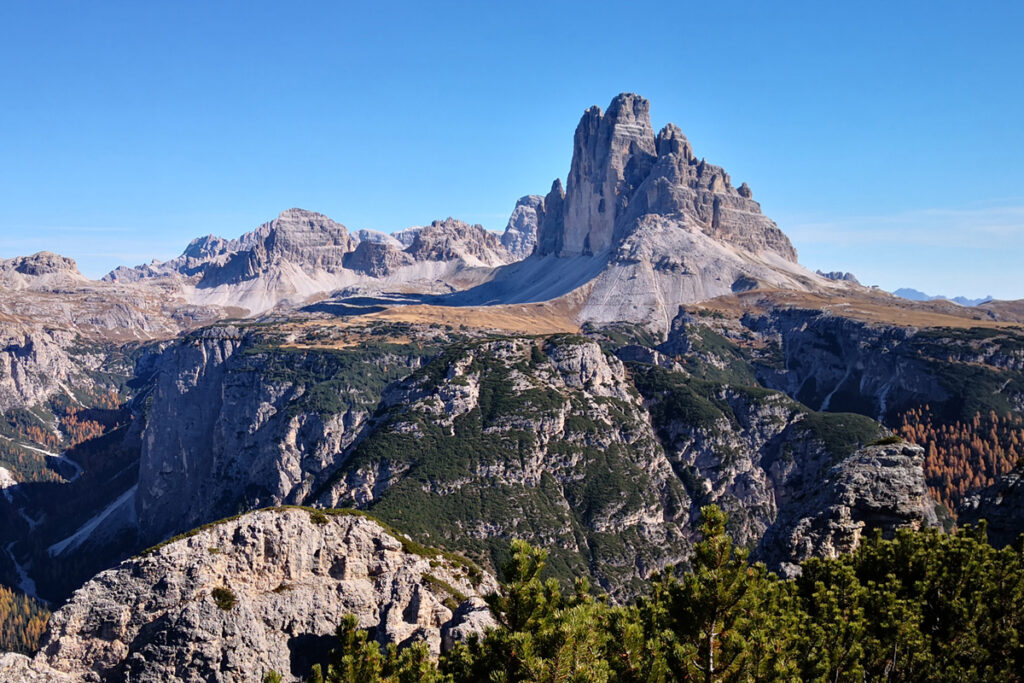
Tre Cime di Lavaredo
Departure and arrival point: Rififugio Auronzo 2320 m (7612 ft) Lago d'Antorno 1880 m (6168 ft) Distance: 11 km (6.8 mi) Elevation gain: ascent 360 m (1181 ft) descent 800 m (2625 ft) Difficulty: Moderate Brief description: hike around the Tre Cime di Lavaredo (Three Peaks of Lavaredo), the undisputed symbol of the Dolomites. TheRead More »Tre Cime di Lavaredo
Pratopiazza
Departure and arrival point: Cimabanche 1530 m (5020 ft) Distance: 11 km (6.8 mi) Elevation gain: 590 m (1935 ft) Difficulty: Moderate Brief description: the trail leads to Pratopiazza, a pristine pasture immersed in sublime peace and surrounded by grandiose mountains. Departing Passo Cimabanche, the trail gradually enters the Val dei Chenope (in German Knappenfusstal),Read More »Pratopiazza
Lake Rudo and the springs of the river Boite
Departure and arrival point: Malga Ra Stua 1668 m (5472 ft) Distance: 9,6 km (6 mi) Elevation gain: 400 m (1312 ft) Difficulty: Moderate Brief description: hike in search of a transient lake and the springs of the river Boite. Malga Ra Stua, reachable either by car or by shuttle service from Fiames, is aRead More »Lake Rudo and the springs of the river Boite
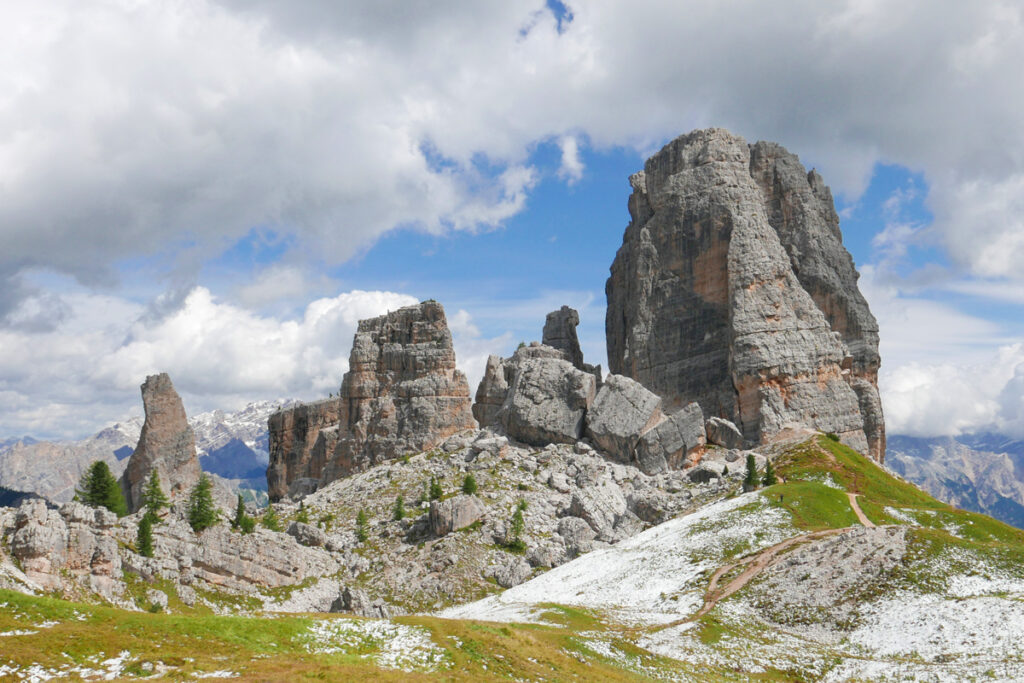
Cinque Torri open air museum
Departure and arrival point: Passo Falzarego 2105 m (6906 ft) Bai de Dones 1890 m (6200 ft) Distance: 8,5 km ( 5.3 mi) Elevation gain: ascent 400 m (1312 ft) discent 550 m (1805 ft) Difficulty: Moderate Brief description: trail in one of the most impressive locations in the Dolomites, with hisorical relevance and scenicRead More »Cinque Torri open air museum